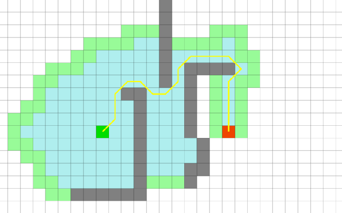
Intelligent-Path-Finder
Implementation of the A-star algorithm to find the most efficient path between two points in the Mendon Ponds Park considering the elevation, terrain type and season. The map of the park is as follows:
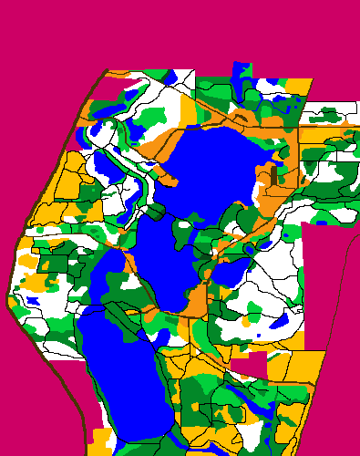
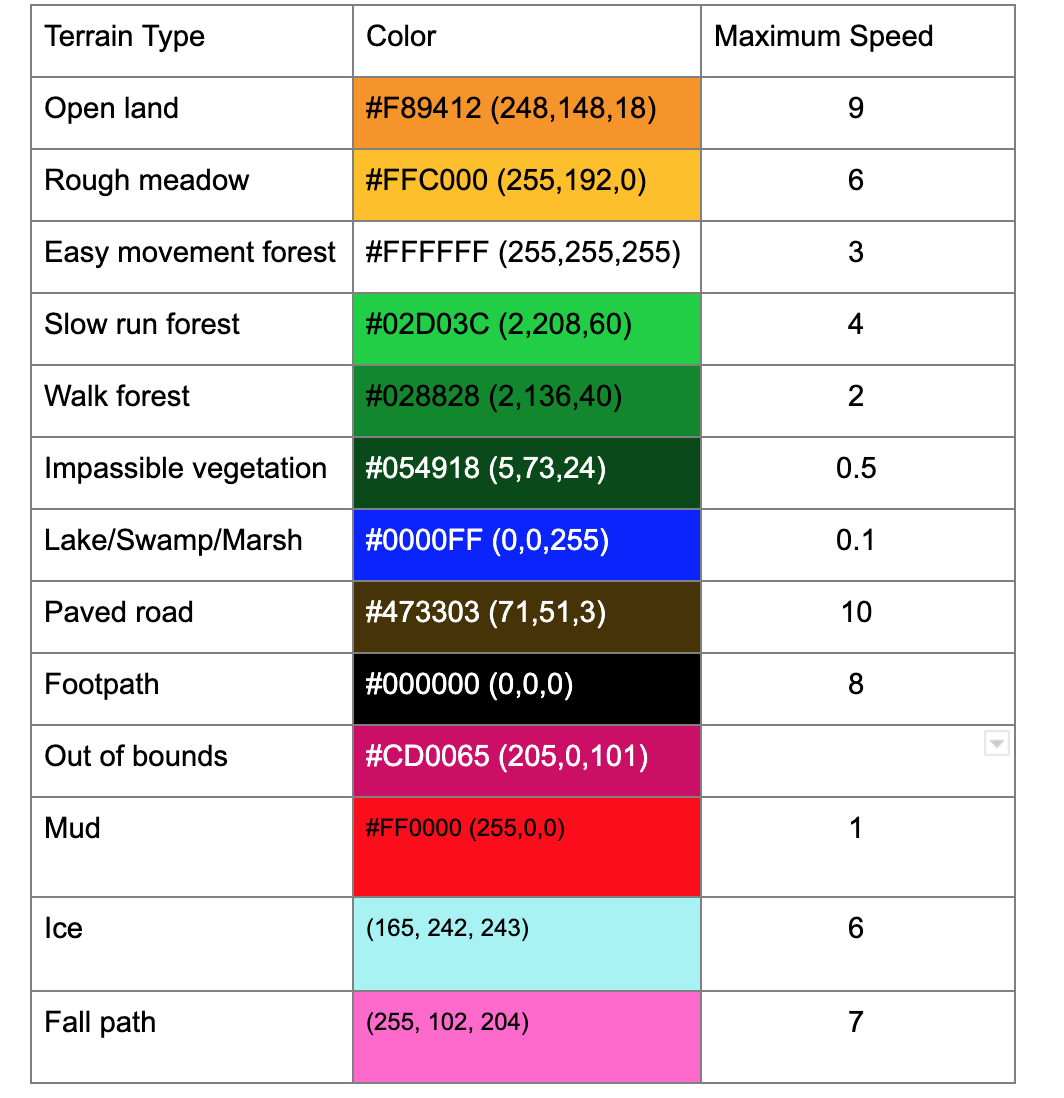
Each color represents a specific type of terrain. All the points are not at the same elevation. The elevation and the pixel size are determined by the National Elevation Dataset. Including the elevation the park looks some like this:
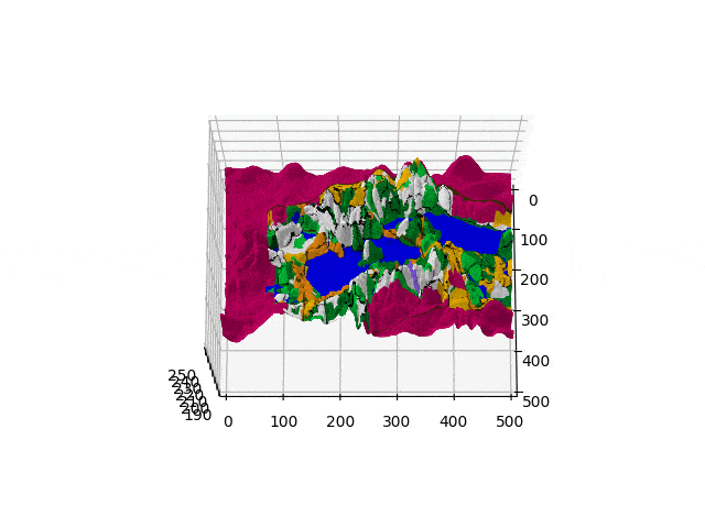
The elevation data can be found here. The map presented is for summer and changes based on the seasons. The changes are explained below
Design
In my implementation I try to minimize the time required to move from one point to another. To do so each color has been assigned a maximum speed.
Heuristic Function
For the heuristic function, I have used the euclidean distance between the two points along with the height and dividing that distance by the best speed i.e. 10. This function does not overestimate since it considers there exists a straight line path from any point to the destination having the best speed. So in the best case, the speed will be 10 and the time for the actual path will be equal to the heuristic distance. This is true for all other seasons as well since for each season we are decreasing speed and not increasing it.
A-star Algorithm
For A-star algorithm, all eight neighboring points have been considered. I have used a priority queue(heap) to find the point with the lowest heuristic value and then that point is removed from the queue. The point is a class that contains the parent from which it was generated, hence when tracing the path we can look at the parent until the parent is None at which point it is the first point.
Path Coloring:
I have created a class node that contains the X, Y, Z coordinates the color and a node to the parent. The parent is the point that generated this point in the queue. So for drawing the path I go from the last point to the first point.
Seasons
Winter
In winter, the waters can freeze. Any water within seven pixels of non-water is safe to walk on. To deal with this first, the water pixels which are next to land are found, next BFS is applied to find the water pixels that are within seven pixels of the border pixels.
Spring
In spring Any pixels within fifteen pixels of water that can be reached from a water pixel without gaining more than one meter of elevation (total) are now underwater To deal with this first, the land pixels next to water are found. Then BFS is applied, but the entry in the queue also contains the height of the water. Hence if a pixel is at a height greater than 1 meter then that pixel is ignored and not colored.
Fall
In the fall, leaves fall. In the park, what happens is that paths through the woods can become covered and hard to follow. So, for fall, the time for any paths through (that is, adjacent to) easy movement forest (but only those paths) should increase, Hence, pixels which are next to easy moving forests are found and are colored pink.
Running the Program
Pre-requisite Pillow must be installed
Lab1.py <image name> <elevation file> <season> <file with set of points>
Lab1.py “testcases/normal/terrain.png” “testcases/normal/mpp.txt” “summer” “testcases/normal/brown.txt”
Sample Output
The black signfies walls which are too high